The fire has crossed the Athabasca River and is approximately 6 kilometrers southwest of Fort McMurray.Lynn Daina
The Fort McMurray fire: Here's how you can help, and receive help
Five years after one of the most destructive fires in Canadian history reduced large swaths of his community to rubble and ash, Slave Lake fire chief Jamie Coutts is again in the heart of a disaster, fighting a raging forest fire in Fort McMurray, Alta.
"It's a firestorm," Chief Coutts said by text, from the fire scene in Fort McMurray on Tuesday evening. "Propane popping everywhere. Sirens everywhere. Brings a flood of horrible memories."
He was among 100 firefighters on the scene in Fort McMurray on Tuesday evening, and 100 more were en route from volunteer and municipal departments around the province, including others from Slave Lake.
Chief Coutts was the face of the firefighting effort during the Slave Lake fire, leading a crew of volunteer firefighters on the front line of a blaze that destroyed a third of the town in hours.
In that case, high winds pushed a wildfire that was burning outside the town into the community on May 15, 2011, and destroyed more than 500 homes and businesses, reducing entire neighbourhoods to ash. At the time, it was the second-largest insurable disaster in Canadian history (after the ice storm of 1998), and caused an estimated $742-million in damage.
Like many others, Chief Coutts had been nervously watching this year's fire season before the blaze in Fort McMurray raged out of control and entered the city.
On Monday evening, he told The Globe and Mail the boreal forest conditions in northern Alberta were the driest they have been in more than 20 years.
"Today, we were ready for everything, and nothing happened," he said on Monday evening. "But tomorrow's tomorrow."
Karl Hill, who was a fire department captain in Slave Lake in 2011, said he, too, felt a growing sense of unease in recent weeks.
"This spring reminded me a lot of Slave Lake in 2011, in terms of the wind and the early warm weather," he said. "I've been nervous the last two weeks hoping that another repeat of Slave Lake didn't happen in Alberta, and unfortunately, today seems to suggest that it has happened. It's unbelievable."
Mr. Hill said he felt sick to his stomach watching images of the fire, and thinking about both firefighters and residents of the community.
"When you see images like that, and having been through that scenario as a first responder, my sense of helplessness is very high," said Mr. Hill, now general manager of community protective services for the town of Stony Plain. "The images aren't speaking to the devastation that probably people are going to wake up to tomorrow. I hope that the outcome is a lot better than what the images are showing. It's a scary, scary, scary scene."
Karina Pillay-Kinnee, the former mayor of Slave Lake, said she was watching news of the fires evolve on Tuesday from B.C.
"It's eerie," she said. "Seeing the images, it just takes you back."
She said she was in contact with the current mayor of Slave Lake on Tuesday. He is a firefighter, and was on a fire truck on his way to Fort McMurray.
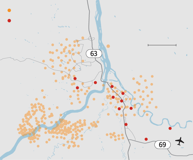
Fire hotspots for the last 24 hours*
Neighbourhoods under mandatory evacuation
0
4
KM
Thickwood
Dickinsfield
Downtown
Wood Buffalo
Lower Townsite
Abasand
Grayling Terrace
Waterways
Beacon Hill
Gregoire
Draper
Saline Creek
0
4
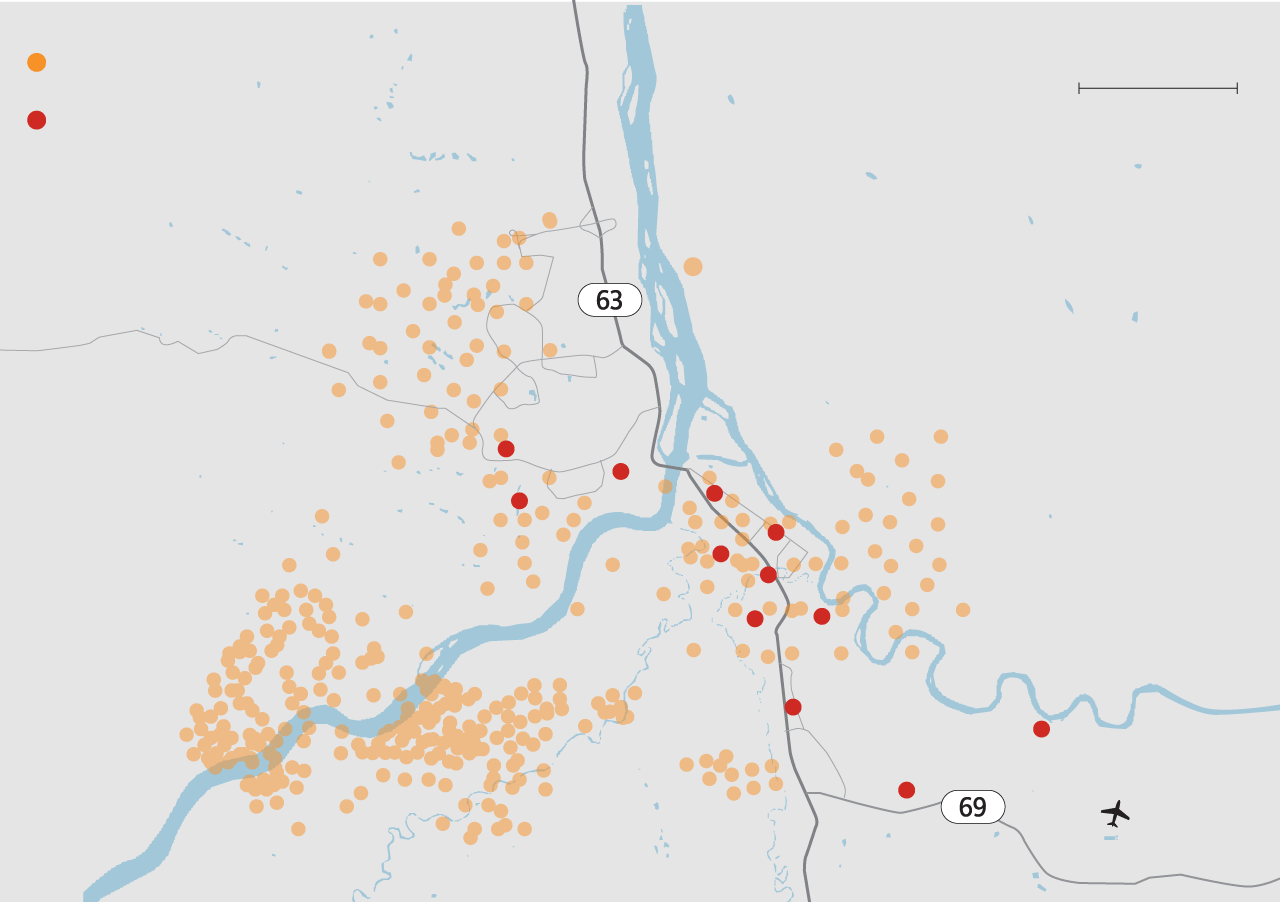
Fire hotspots for the last 24 hours*
KM
Neighbourhoods under mandatory evacuation
Thickwood
Dickinsfield
Downtown
Wood Buffalo
Lower Townsite
Abasand
Grayling Terrace
Waterways
Beacon Hill
Gregoire
Draper
Saline Creek

0
4
Fire hotspots for the last 24 hours*
KM
Neighbourhoods under mandatory evacuation
Thickwood
Dickinsfield
Downtown
Wood Buffalo
Lower Townsite
Abasand
Grayling Terrace
Waterways
Beacon Hill
Gregoire
Draper
Saline Creek

0
4
Fire hotspots for the last 24 hours*
KM
Neighbourhoods under mandatory evacuation
Thickwood
Dickinsfield
Downtown
Wood Buffalo
Lower Townsite
Abasand
Grayling Terrace
Waterways
Beacon Hill
Gregoire
Draper
Saline Creek
Fort McMurray Intl Airport
 Jana G. Pruden