Our World
In recent decades, space flight has given humanity a chance to gaze down on all of the planets and plenty of other assorted worlds – with Pluto the latest. But nowhere else in our solar system is there a planet like this. Earth has an atmosphere that is at just the right temperatures and pressure to allow water to exist in liquid form at the surface. And it has been like this for billions of years, allowing life to appear in the oceans long ago and then spread onto land. Today, astronomical observations of distant stars suggest planets are common in the universe. But astronomers have yet to find evidence of any planet that is a plausible candidate for hosting life, let alone a civilization.
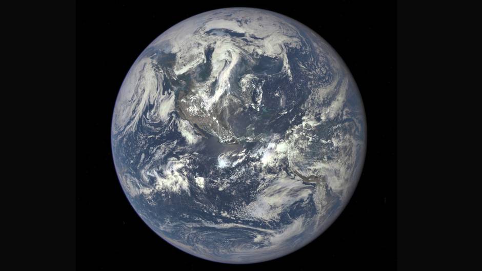
Blue Marble
Images of Earth from space date back to the 1960s, but nothing captured the public imagination like the iconic Blue Marble photo taken by Apollo 17 astronauts on Dec. 7, 1972, on their way to the moon. As the first ever “whole Earth” shot, it captured the sun-facing hemisphere of the planet full on, portraying our world, looking both hospitable and fragile, against the cold, black depths of outer space. It became one of the most reproduced images in history and a rallying symbol of the environmental movement. But while popular, this particular perspective on Earth was no longer an easy one to get once the moon landings stopped. The space station is too close to see the entire planet at once, and missions to other planets are typically departing from a direction that shows the Earth only partly illuminated.
Triana
In March, 1998, just months after nations agreed to limit emissions of greenhouse gases under the newly drafted Kyoto Protocol, Al Gore presented the idea of building a dedicated satellite to do for the Web generation on a daily basis what the Blue Marble photo did for the Me generation. In response, NASA came up with a mission called Triana, named after Rodrigo de Triana, said to be the first of Christopher Columbus’ crew to sight the new world. The project was soon nicknamed Goresat. House Republicans viewed it with disdain and moved to block funding. After a budget tug of war, Triana was built, but when George W. Bush took office in 2001 the satellite was shelved – literally.
Solar Wind
Electrically charged particles are constantly streaming toward us from the sun and are deflected by Earth’s magnetic field. At times, ferocious and sudden outbursts on the sun called coronal mass ejections can turn the solar wind into the particle equivalent of a hurricane, wreaking havoc with commercial satellites and the electrical grid on Earth. Triana was reborn with a new name when scientists realized it could be used to replace a different satellite that was designed to measure the solar wind upstream of Earth and warn us about approaching disturbances. With the support of the Obama administration, a repurposed Triana, now called the Deep Space Climate Observatory (DSCOVR), got the green light in 2013 and was launched in February of this year.
L1
After a four-month journey, DSCOVR was manoeuvred into position at a mathematically special point in space, roughly 1.5 million kilometres from Earth, called L1 (after the 18th century French mathematician, Joseph-Louis Lagrange). At this location, the gravitational influence of the Earth and the sun balance out in such a way that a satellite can orbit the sun but keep pace with Earth. This is an ideal location for placing a satellite that can provide up to an hour’s warning about energized particles heading our way from the sun. A side effect is that the satellite is always facing the sunlit side of Earth. It’s the perfect vantage point for a Blue Marble photo, over and over again.
Camera
In addition to detectors for monitoring the solar wind, DISCOVR is equipped with a telescopic camera that can image Earth at 10 different wavelengths, from the ultraviolet to visible light to infrared. The information gathered by the camera not only provides an image of what Earth looks like but delivers a range of measurements that relate to the presence of ozone, aerosols, cloud height and abundance, and vegetation growth on the surface. All of these are factors in Earth’s climate system and can be used to help refine climate models as DSCOVR monitors the planet.