the storm
Seventy per cent of the Earth’s surface is water, though most people focus on the other 30 per cent. Henk Ovink keeps his eyes on the line in between. A wiry, fast-talking expert on water management, Mr. Ovink grew up between sea and land, in eastern Holland. “It is a place that is made out of water,” Mr. Ovink says of his home country.
Now Mr. Ovink’s job is to explain to the rest of the world, as his country’s Special Envoy for International Water Affairs, how the Dutch have done it: how they’ve thrived, over nearly 1,000 years, by building a complex network of dikes, dams and floodgates to hold back the sea. “We survived not only because we have great engineers and designers,” he says, “but mostly because we have learned to work together. Even before we were a kingdom, we built a collaborative approach to build a safe place for all.”
As the mayor, you can save this city

People in Cladis, a city of one million on the banks of the Cladis River, are growing nervous about weather in a changing climate. Your task is to allocate resources to help prepare – before time runs out.
He hopes cities across the globe will follow that example. With the increasing effects of climate change, urban dwellers must brace for a new reality in which extreme weather events are more frequent, less predictable – and more deadly – than ever before. Two to four billion people in coastal regions could be hit hard. We are all, in a sense, Dutch.
Except that we, unlike the Dutch, don’t have centuries to get used to our new, endangered status. In Canada, scientists predict that climate change will mean rising sea levels that affect Vancouver; glacial melt and flooding, but also water shortages, on the Prairies; more frequent and powerful storms battering Montreal and Toronto with ice and vicious rains. The 2013 storms in Alberta, which killed five people and made a $6-billion mess, will not be the last to shake the country.
Our need to cope with long-term climate shifts – known by the bland term “adaptation” – is acute. “You hear lots of people talk about climate change, but very little on adaptation to climate change,” says Blair Feltmate, an ecologist at the University of Waterloo. “We need to be doing that. Right now. And we need to think about where water is going to be 25 or 50 years from now.”
The challenge goes beyond high water. It is, in fact, so vast and diffuse that it’s hard to get our heads around it, a drumbeat of disaster demanding action: emergency-response plans, new wetlands, stronger power grids, big piles of soil and clay. Some of it will be hard and expensive; some will be easy. None of it will be possible without a change of mindset.
“We have a management-by-disaster mentality,” Dr. Feltmate says. “What we need to do is take a different approach – to avoid having problems in the first place.” In other words, we need to live and build like the Dutch.
Remaking our culture, and our cities, will be slow work. North America’s richest and most influential city, New York, was hit by Hurricane Sandy in 2012, and it is thinking big about resilience – yet changes there are still difficult to detect. Even the Dutch have needed a reminder: the country’s largest new sea defences were put in place after the infamous North Sea Flood of 1953, which killed more than 1,800 people.
A generation ago, Canada learned similar lessons from disasters, and responded. The Red River floodway was built after Winnipeg was washed out in 1950, and in 1954 Hurricane Hazel led to the creation of the Toronto Regional Conservation Authority to preserve that area’s rivers and ravines. Do we need to be slammed again before we move to protect ourselves for the future?
New York state of mind
In a city of islands, bays and peninsulas, the sea has always been there, coursing and lapping, rarely raising its voice.
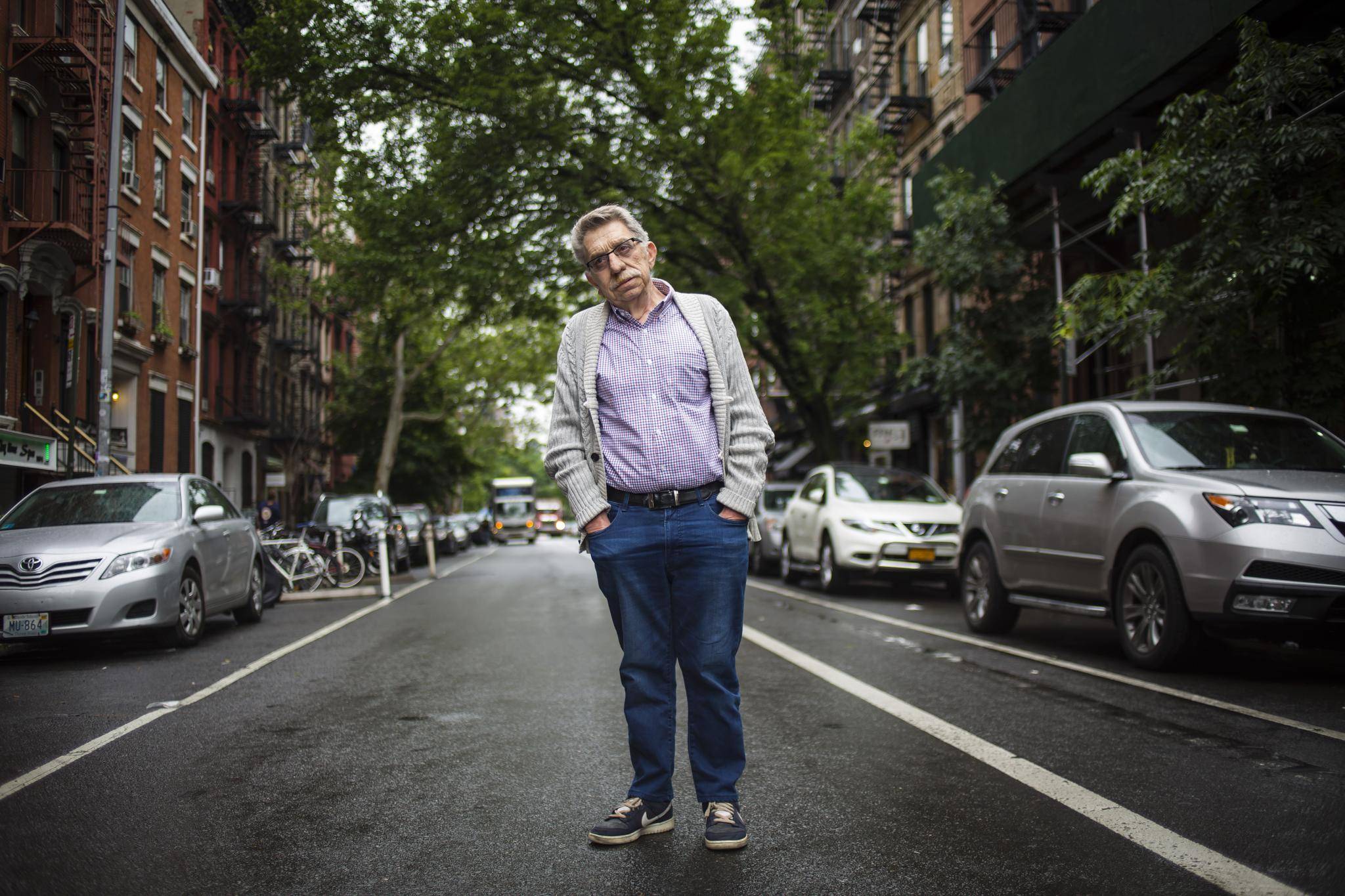
Victor Papa never worried much about it. He has lived his 70 years in a neighbourhood – the Lower East Side of Manhattan – where the East River will occasionally flood across the concrete and asphalt. “All my life,” he says, “we were part of the river. We were in the river. ” So on the night that Hurricane Sandy blew into New York, promising disaster, he scoffed at the TV. “The lights were on, and I said, ‘These weather reports are exaggerated. What are they trying to do?’ Then, I heard an explosion.”
It came from an electrical substation about three kilometres north of his apartment. The local power utility, Con Edison, had built it to survive the highest recorded storm surge, from 1956. Sandy pushed the water about a foot over the top. The substation went up with a blue flash and a boom. Mr. Papa’s lights went out. More than 600,000 people were without power, and often without water, for a week. “The impossible became possible,” Mr. Papa says.
For the city’s government, the storm was sobering. “Sandy really highlighted the risks for us,” says Daniel Zarrilli, director of the New York Mayor’s Office of Recovery and Resiliency. “It revealed a lot of the vulnerabilities we knew we had – showing them up in a very stark way.”
Yet the superstorm did not catch New York totally unprepared. Although Mr. Zarrilli’s office was established after the storm, the city and local experts had spent years thinking about resilience – the capacity to prepare for, and respond to, crisis. The city even has its own Panel on Climate Change, which assesses local risks. But how ready was it for Sandy in Mr. Papa’s neighbourhood? Not very, by his account.
In the days after a disaster, there is crucial work to be done in getting a city back up and running: providing medical care, water, food, power. On the Lower East Side, city agencies and the Red Cross were hardly in the area at all, Mr. Papa says. He is the director of Two Bridges Neighbourhood Council, a non-profit group that manages two towers of rental housing. One of them, 10 storeys tall, houses seniors, and its elevators failed when the storm flooded the basement.
Two Bridges, a tiny organization, found itself delivering food and water, and checking on residents’ well-being. Mr. Papa mentions one tenant, an elderly single woman who is deaf and has limited mobility. “When you rang her doorbell, a light would go on in the apartment – but now that didn’t work. So she was wondering what the hell was going on.” Only Two Bridges staff – her neighbours – knew how to help her.
This sort of local knowledge and engagement is known as “social resilience,” and it was especially important in the Lower East Side and surrounding neighbourhoods.
It is also easy to overlook. Forty-four people, ages two to 90, died in New York, and most of them lived along the sea. Their deaths, and the physical devastation of waterfront neighbourhoods in Brooklyn and Staten Island, drew much of the media coverage. Yet in Lower Manhattan, the storm affected hundreds of thousands more people: the social cost was, in Mr. Papa’s words, “a human disaster.”
‘Giant global loudspeaker’
In planning for resilience, policy-makers have to play Solomon, and in a city of 8.4 million people, with 835 kilometres of coastline, the scale of the challenge is monumental: Mr. Zarrilli is now overseeing 257 projects in New York.
The aftermath of Sandy presented a rare opportunity “to buy down risk,” Mr. Zarrilli says. The federal government poured $10.5-billion (U.S.) into the country’s Northeast for reconstruction after the storm, including $3.2-billion into New York alone.
The city’s $3.7-billion coastal resiliency plan includes many small projects, such as green roofs and bioswales – small gardens that capture and absorb stormwater. None will be transformative, but they will have a cumulative impact.
There are also, necessarily, some massive projects. A high-profile design competition called Rebuild By Design – run in part by Mr. Ovink – solicited big ideas to build resilience. One of the winners was called the Dryline, and its face is the Danish architect Bjarke Ingels. Mr. Ingels, at just 40, has become one of the world’s most prominent architects on the strength of his ability to reframe tough problems with so-crazy-it’s-brilliant leaps of logic.

In this case, Mr. Ingels sees New York’s infrastructure spending as an opportunity to make a more beautiful city. “The Chinese character for crisis is the combination of ‘danger’ and ‘opportunity,’ ” he tells me in his Lower Manhattan office, overlooking the harbour from the safety of the top floor. The Dryline team included nine other firms of landscape architects, ecologists and planners. They imagined a system of flood protection looping around the tip of Lower Manhattan and also serving as parks and open space. “Our thinking was: What if you design it from the get-go for positive social impacts?” Mr. Ingles says.
The Dryline is as sexy as infrastructure gets. In drawings, it is imagined as a series of verdant hills, flip-up barriers, Technicolor planters and benches – all designed to animate the edge of the water while controlling floods from the rivers and the harbour. The project, as it gets built, could set an important global benchmark.

“Manhattan is a giant global loudspeaker,” Mr. Ingels says. “Anything you say here is definitely heard louder and clearer. Which raises the bar and responsibility to build precedents.”
How much of the Dryline’s elegant urban design will get built is an open question. So far, only one section is underway, a $335-million (U.S.) first phase covering an East River area that houses an aging and vulnerable population, and the power plant that turned out Mr. Papa’s lights.
But its berms will stop at the northern edge of the Lower East Side. In a storm, it will not help the buildings overseen by Mr. Papa and Two Bridges – maybe the opposite. If the river floods and hits the barriers to the north, will the water push even farther into their streets? “We’re very concerned about overflow,” says Two Bridges associate director Kerri Culhane. “We realize we’re on the front line here, and nothing is being done to protect us.”
The city is studying that issue, but there are many other challenges to consider. To survive in an unpredictable climate, a society must always be thinking about weather: What is the worst case? And how can we be ready?
A successful case study is visible from Mr. Ingels’s office windows: Governors Island. The northern half of the 172-acre island is on high ground and houses structures dating back to the American Revolutionary War. West 8 – a Rotterdam and New York-based landscape architecture firm that won a design competition to remake the island as a park – focused on the southern part, where the Coast Guard had built on landfill.
Its solution was what West 8 partner Jamie Maslyn Larson calls “transformation through topography.” It raised the level of the ground in the vulnerable section by about four metres. Some areas around the fringes were designed as lawns and ball fields, with grass and trees that can handle a drink of seawater. As the site rises, curvaceous white concrete curbs direct floodwater along paved paths and back to low ground.
The Trust for Governors Island, the nonprofit group that runs the site, footed the bill for this strategy, which involved shipping 80,000 cubic yards of landfill onto the island. That paid off right away. The park had begun construction in October, 2012, and when Hurricane Sandy was coming in, the construction crews parked their machines on that new, higher ground. The floodwaters that night exceeded the most current 100-year flood projection – yet the excavators and graders remained dry, and much of the park, including hundreds of new trees, survived more or less intact.
“The next day, we were ready to get back to work,” says Ellen Cavanagh, the trust’s director of planning, design and construction. “I’m glad,” she adds, “that our landscape architects were Dutch.”
The Dutch way with water

In his 1936 poem Memory of Holland, Hendrik Marsman wrote: “in every district/ the voice of the water/ with its eternal disasters/is heard and is feared.” If any nation understands the vagaries of weather and water, it is the Netherlands. Huge areas of the country’s land mass have been reclaimed from the sea, and its waterways have wandered dangerously, growing and shrinking and changing shape, through the centuries.
Yet despite nearly a thousand years of building against the sea, it took two disasters in the 20th century for the country to get its defences in order. The Netherlands was hit by a deadly storm surge in 1916, and then in 1953 the North Sea Flood hit. This event “was like the 9/11 of Holland,” says Adriaan Geuze, a principal of West 8.
The response was the Delta Project, a collection of public works that reshaped the coast of the southwestern Netherlands. A comprehensive system of surge barriers, dams, locks and dikes was designed to deliver particular levels of flood protection, dictated by legislation – work that continued through the 1990s. In other words, reestablishing a comfortable level of protection against the sea took half a century. “It’s a myth that you wake up the next morning and everything will be okay,” Mr. Ovink says. “But that is not a reason to stand still. You should start now: it will take a generation.”
The Dutch tradition of reclaiming low-lying land goes back about 1,000 years. After storms reshaped the coast in the 12th century, the Dutch drained and protected increasingly large swaths of terrain. Water management became central to the culture and politics of the area; farmers and landowners pooled resources. Count Willem II of Holland founded the first water board in 1255, and the modern Dutch state has 25 of them – regional bodies responsible for water barriers and management, each governed by an assembly of households, landowners, building owners and industry representatives.
The boards, elected through a different system than local or federal governments, have the independence to think long-term. That capacity, Mr. Ovink says, is crucial. “Most places only respond to a disaster,” he says. “I work all over the world and I see this: A long-term regional plan will fail to build resiliency if there is not the institutional capacity to lead it over the years.”
The contemporary Dutch approach to water management includes large and small moves. Rotterdam, the country’s second biggest city, is 90 per cent below sea level. It is protected by infrastructure measured in kilometres; its main shipping channel has a 13,000-tonne pair of surge gates that can be closed in anticipation of a storm.
Its urban design and architecture are also prepared to reduce the impact of extreme weather. As Mr. Ovink says, “You can’t keep an umbrella over the whole city.” Rotterdam and the local water board commissioned the design of a downtown “water square,” which captures rainwater from nearby buildings and streets.
The design by local firm de Urbannisten makes a spectacle of the water as it moves over falls and through glimmering steel gutters, disappearing into a massive holding tank and being slowly, safely dispersed.
But the Dutch also realize their previous strategies won’t be enough. Along the Rhine River and its branches, large areas have been enclosed by dikes over the past 1,000 years. Now, climate scientists are recording heavier rains and predicting still further increases. In the Netherlands, as elsewhere, the sort of event that used to be a 1,000-year storm or a 500-year flood is happening with distressing regularity. The historic solution – building dikes higher and higher – will no longer work.
And so the Netherlands is well into a new set of water projects, called Room for the River, that turn 1,000 years of tradition upside down – working with, not against, the water. “We have reinvented the past,” Mr. Ovink says. Its 39 sites are employing every imaginable water-management tactic, from creating new reservoirs to deepening riverbeds. In many places, they are lowering barriers, removing dikes and – strategically – allowing the rivers to flood on a grand scale.
In Nijmegen, the country’s oldest city, this means broadening the River Waal. Instead of raising dikes, a Room for the River project is moving them back by 350 metres. In the resulting space, a new channel has been cut to expand the river. The city, to the south, gains a measure of safety; a new island in the river adds to the region’s parkland, and the city is building a new quay and constructing housing on the north side.
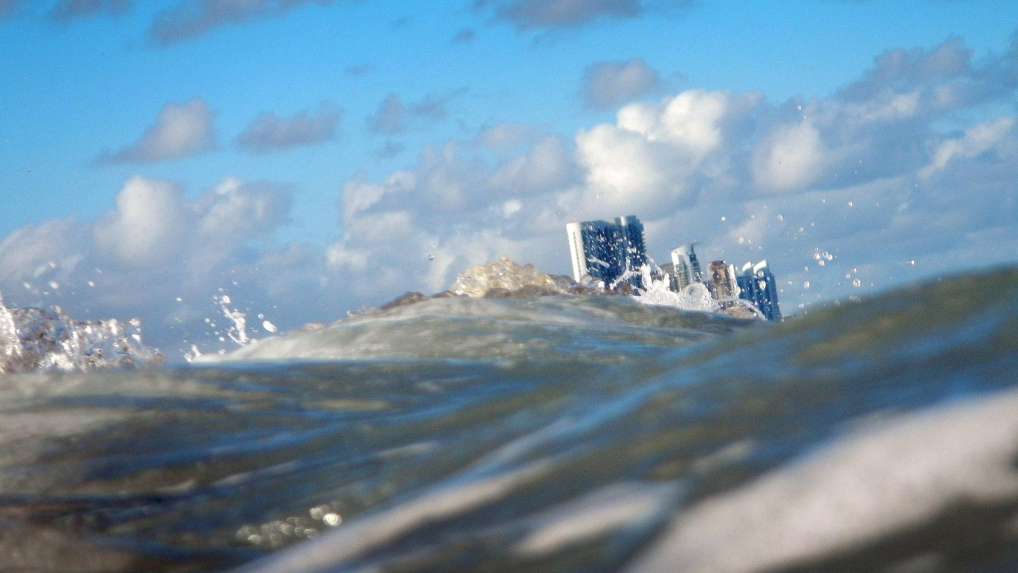
The view from Miami
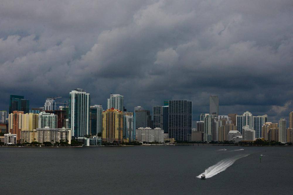
“Beyond the dire warnings, something else is happening in South Florida. Here, for the first time in North America, the conversation is no longer just about what climate-change countermeasures or conservation initiatives to pursue – taking shorter showers or subsidizing electric cars. It’s about a much more existential question: What if it’s too late?”
However, the land that’s being surrendered to the river was not empty. A village, Lent, was home to about 50 families. “In the beginning, [those] people were not happy,” says Karsten Schipperheijn, a project manager working with the local government on the plan. Some were farm families “who had lived there for ages,” and some were retirees who had moved into this green area “to live there for the last 20 beautiful years of their life.”
The answers: money, and respectful conversation. “We had discussions at their kitchen tables – it was important to hear their stories,” Mr. Schipperheijn says. In the end, the city was able to address their concerns: Every one of the 50 households voluntarily accepted a buyout.
To Mr. Geuze of West 8, this response is characteristically Dutch. “In Holland,” he explains, “the social and political acceptance of water measures is fundamental. If government wants to change something to build a road, it is a not-in-my-backyard culture. But for water, it is different.”
For Americans, and even for Canadians, it will be impossible to replicate the long tradition of public works on which the Netherlands is founded. But Mr. Ovink suggests that the very process of assessing our vulnerabilities, and correcting for them, can itself change our culture. One engineering solution “in itself doesn’t build resilience.” he says. “We need a suite of interventions – and that over time builds social resilience.”
Canada: of rivers and seas
Social resilience is a technical term for a simple concept: the capacity of community members to take care of each other. And Mr. Ovink’s idea is an elegant one. This spring, Ottawa launched a $200-million National Disaster Mitigation Program. Could Canadians pull together on resilience as a new national project, despite the country’s geographic spread and its differences of culture and climate?
If so, it would be by thinking of climate change and resilience in very personal terms. Alec Hay, a civil engineer who teaches resilience planning at the University of Toronto, has set students an exam question: An elderly woman lives alone, and she is isolated after a winter power outage. How does she eat? Who looks after her? Engineering has no answers. “Difficult things will happen,” he says. “People have to look after each other.”
A major ice storm or flood is likely to generate massive infrastructure problems as well, so resilience must also involve turning the lights back on. The policial and conceptual problem is that there is no one-size-fits-all strategy: In Canada the disaster scenarios vary between ocean cities and river cities. The challenges, and their solutions, are local.
The picture along the ocean is complex, says Glenn Milne, Canada Research Chair in Earth System Dynamics at the University of Ottawa. Sea-level rise “is not going to be a tidal wave smashing things to bits,” he says. “It’s going to be slow, eating it away faster and faster. And then there will be storms.” What it will look like depends on where you are. For most of Canada’s coastline, the impact of climate change will likely bring sea level down – but at a certain point as you move south, sea level will start to rise. In Nova Scotia, he predicts, many buildings and towns will be vulnerable to flooding. “There are lot of houses close to the coastline. That area will be one of the hardest hit in Canada.”
Vancouver, with its large population and flood-prone low geography, will be more vulnerable. “If you look at a map of Vancouver and imagine a sea-level rise of one metre, you get a totally different city,” says Craig Applegath, a Canadian architect who consults on sustainability and resiliency. (A worst-case scenario of an 80-metre sea-level rise is shocking.) Indeed, the city is implementing an adaptation strategy that includes hardening individual buildings against flooding and limiting development in flood plains. A 2013 study suggested that the city would be among the top-20 most vulnerable in the world, but that local measures would provide some degree of protection.
For river cities, climate change is likely to mean more rain and storms of greater frequency and magnitude. On the Prairies, warmer temperatures bring increased snowmelt. “In Edmonton and Calgary, the rivers are fed by the Rockies,” Mr. Applegath says. “As the climate warms, you have the snowmelt from the winter before happening in the spring, plus you have the glaciers – which have been there forever – melting. You add a flash storm and you get [the Calgary flood] again.”

Kim Sturgess, a Calgary water engineer, says the city is unusual in being so close to the mountains. “Where in a major storm Winnipeg will get a gigantic amount of water, they’ll get four days’ notice,” she says. “We get half an hour.”
To be ready on that kind of notice demands that everyone has a sense of what’s coming. That sense has been in place in Calgary for a while: The city built its environmental operations centre and improved its planning after the floods of 2005, and was quite well-prepared for the 2013 flood. When it is again time to evacuate, many Calgarians will be ready.
Preparedness is one thing; prevention is another. Late last year, Ms. Sturgess authored a report that looks at the Bow River basin with a Dutch eye. “How do you give the river room to move so it doesn’t cause a lot of damage?” Ms. Sturgess asks. “If you look at that study, here in the Calgary area, every option about what to do was put on the table.”
The report emphasizes the naturalization of the river’s edges and imagines relocating old infrastructure, more buyouts of property owners, limiting new development, closing of old infrastructure sites and returning them to the river. “There are a lot of different ways of going at the issue, and they need to be assessed,” Ms. Sturgess says.
Some major projects have already been put in motion, though critics argue they are more about gratifying political impulses than meeting infrastructure needs. In the wake of the 2013 storm, the Prentice government was focused on big infrastructure works, the sort of project that brings the sense of reassurance – and the political payoff – that more nuanced strategies do not. The government announced three major projects along the Elbow River, including the Springbank Off-Stream Reservoir introduced last September. It would add a new dam and berm to divert water from the Elbow, when the river floods, into a new basin west of Calgary. The reservoir had not been anticipated by local water management plans, and the proposal faced stiff oppositiuon from some locals; during this spring’s campaign, the NDP signalled that it would oppose that project.
Since taking office, the Notley government has not yet firmed up its position. Jason Penner, a public affairs officer with Alberta Environment and Parks, says the department is still waiting for direction. “There will likely be a test checking how the three Elbow River projects would go together – a cost-benefit analysis of having all three,” he says.
Deadly lessons of Hazel
What good is an analysis if government won’t follow it? Or if each new government sees the need to revisit its assumptions? Without long-term commitments from the province and municipalities, and the steady financial backing of the federal government, building resilience in Canada – or anywhere for that matter – is impossible.
Globally, Mr. Ovink says, this is a profound challenge. “The problem with big projects is that they take a long time,” he says with a laugh. And on the other hand, slow consultative work doesn’t pay off politically. “Nobody wants to be the mayor who built a plan,” Mr. Ovink says.
In some places, it is the insurance industry that may lead the way toward a better understanding of the issues. Dr. Feltmate works on research with the insurer Intact, which is spearheading pilot projects for soft infrastructure, such as planting new wetlands to help with drainage, on both the Atlantic and Pacific coasts. So far the Canadian insurance industry has little exposure to flood events, since overland flood insurance is largely unavailable here. But the floods of 2013 had sewers backing up in the Toronto neighbourhood of Downsview, several kilometres from the nearest river. Insurers largely paid for the repairs, though Feltmate says they are reluctant to cover the endangered area. Where is next?
“Calgary was a $6.1-billion flood, the worst in Canadian history,” Dr. Feltmate says. “But what worries the insurance industry is the $30-billion flood that wipes out the Fraser Valley. Or the flood that wipes out Kingston. Since there’s no chance we’re going backward on climate change, this is what we have to think about.”
Even if Canada moves in the right direction, Mr. Ovink cautions that the next few decades will be wet and wild. “There will be devastating events,” he says. “There will be casualties. Just because you understand a risk doesn’t mean it won’t hit you.”
This week Toronto, the province of Ontario and the federal government announced $5-million toward a proposal to renaturalize the mouth of the Don River in downtown Toronto – work that will soften the edges of the river and make it less prone to flooding. It’s a move in the right direction, but small and overdue. It will allow important new development in the area – and yet existing neighbourhoods to the east of the river are vulnerable to flooding right now. “You can’t let a portion of the city float out into the lake,” says community activist Julie Beddoes, “when there are plans in someone’s drawer to fix it.”

The other side of the river – downtown Toronto – is lucky that such a washout hasn’t already happened. That too is a flood plain. Until recently, a large hurricane along the Don River could have sent water coursing through King and Bay streets, flooding subways and crippling the country’s largest city. And that danger was never a major political issue. A solution – a berm, or earthwork, along the Don River – was first proposed in the mid-1980s. The government agency Waterfront Toronto finally built a $135-million, 8.5-metre-high bank of soil and clay in 2012.
A weather-related disaster would help focus the minds of citizens and governments. But of course Toronto has already had one: Hurricane Hazel in 1954. West of the Don is the Humber, Toronto’s other major river. Here, in a broad swath of valley, lies Raymore Drive, where Hazel hit with its deadliest force. The river dammed up with debris at a bridge, then broke loose and swamped a stretch of modest suburban houses. Thirty-two people lost their lives in one little block.
I went there this week to see where their houses once sat. The area is now public land, one of the many ravine parks managed by the region’s conservation authority to keep the city safe from more floods. An odd meadow of wildflowers fills the valley floor, a few ash and ironwood struggling with what’s buried under the surface. In the water, ragged hunks of concrete from the broken bridge remain where they fell. This is where Canadians once made room for the river – proof that we are able to adapt, after we have been hit hard enough.
Alex Bozikovic is The Globe and Mail’s architecture critic.