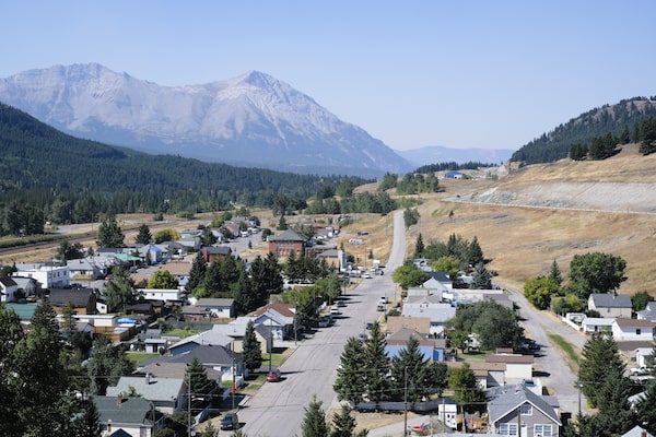
The community of West Coleman in Alberta's Crowsnest Pass. The Nature Conservancy of Canada and Miistakis Institute are using wildlife cameras to understand how wildlife are moving throughout the area to reduce the potential for collisions with vehicles on Highway 3 through the area.Kyler Zeleny/The Globe and Mail
The Nature Conservancy of Canada and Miistakis Institute have completed the first year of their three-year project called Linking Landscapes.
Using wildlife cameras to monitor the Crowsnest Pass, the project will help better understand how wildlife are moving throughout the area where vehicle-wildlife collisions are quite common.
Thirty-seven remote cameras were installed along Highway 3 in the wildlife corridor owned by the NCC, utilizing the help of 21 volunteers who have put in over 333 hours to help with the program. The hope of the program is that the results will help inform motor vehicle accident mitigation efforts in the area and help lower the risk of collisions for both people and wildlife.
“The corridor is a pretty special area for wildlife,” said Emilie Brien, natural area manager in the Crowsnest for NCC. “We have the highest density of biodiversity of mammals in North America. Plus the corridor is a bottleneck where animals have to cross the highway. Vehicle-animal collisions are a real problem here on Highway 3, so we decided that we needed to study the wildlife movement in that corridor to better understand where they are moving and how they move.”
Collecting data for three years, the project will compare wildlife activity with wildlife vehicle collision data and recommend road mitigation measures to help wildlife move safely across the highway.
“It’s hard to tell after just one year, we can’t really draw hard conclusions. But we are starting to see patterns, especially between different species,” said Ms. Brien. “The elk are more in the middle of that wildlife corridor. Wolves and moose seem to be more on the westside of that corridor. We are starting to feel a bit of a pattern, but we cannot conclude anything with just one year.”
Volunteers have been helping with the project by managing cameras and classifying images using the WildTrax platform.
“My camera is west of the Pass. It is interesting watching the animal behaviour because you can get a sense of the behaviour this summer,” said Monica Zyla, a volunteer with the project. “Some people are less aware of our impact on the landscape, so this is an opportunity to contribute to educating people. Helping them understand we do make a difference and there are things that we can do that help mitigate our impact.”
From bears, to cougars and deer, the Crowsnest Pass corridor is a route taken by many animals as they traverse the land. Projects like this will help enhance the understanding of those animals, working toward creating mitigation for safety of both vehicle and wildlife.
“We are encroaching on their habitat and every year encroaching more,” Ms. Brien said. “It is important for them to be able to move between these protected areas.”
Lethbridge Herald