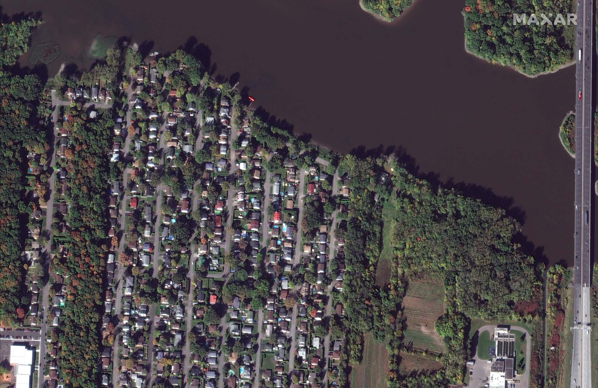
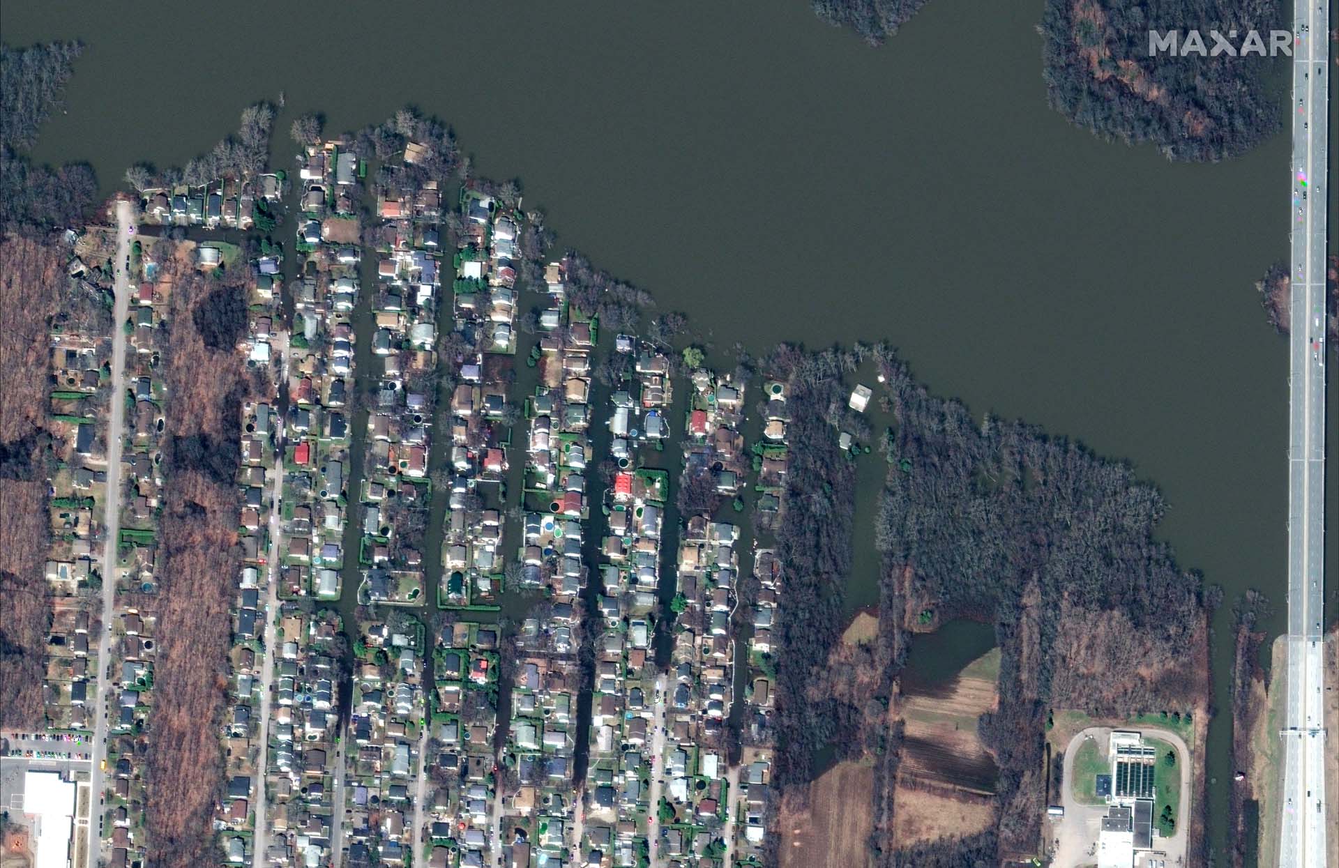
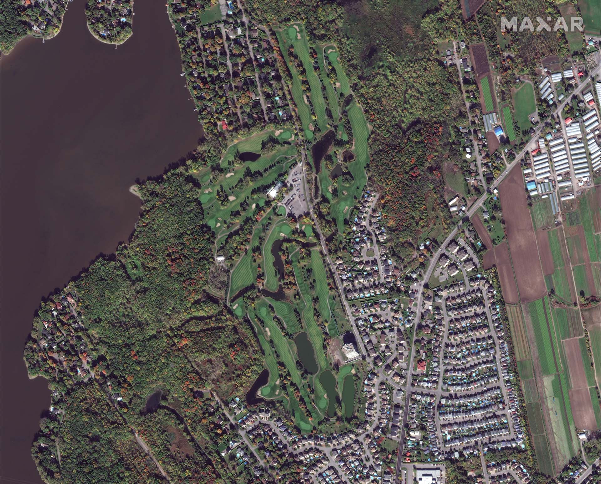
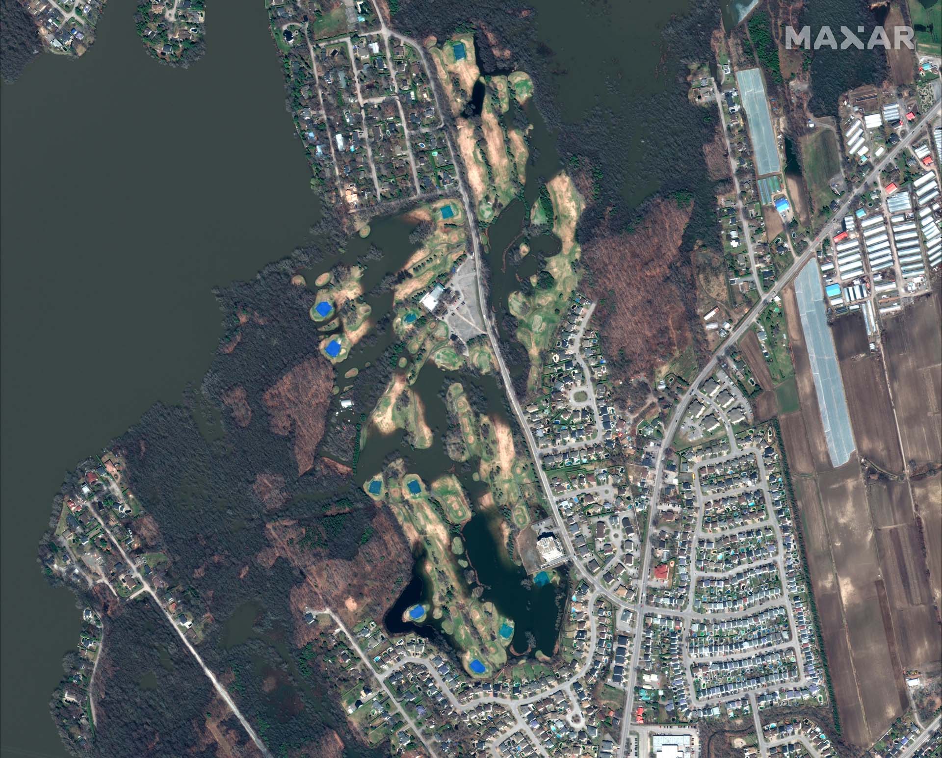
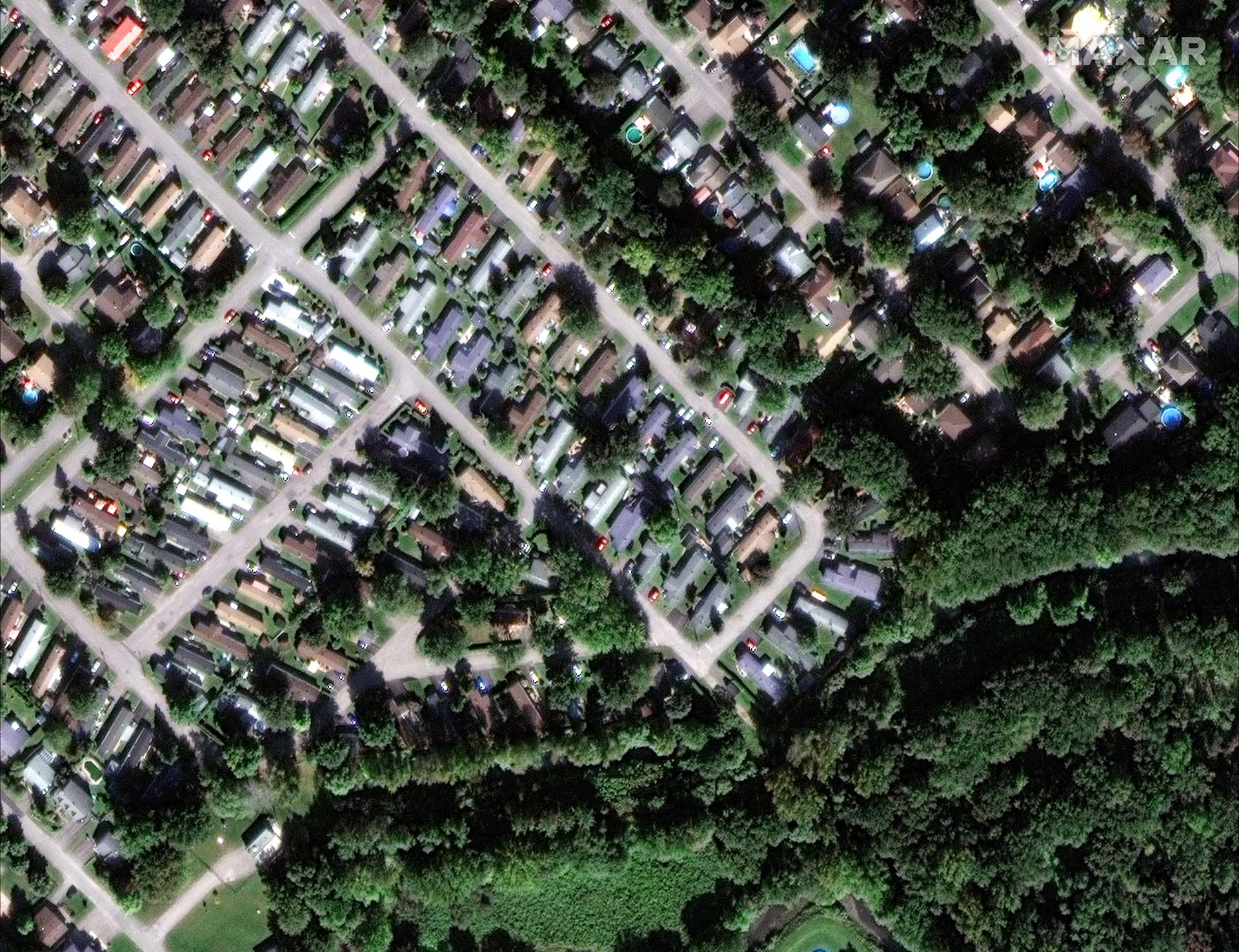
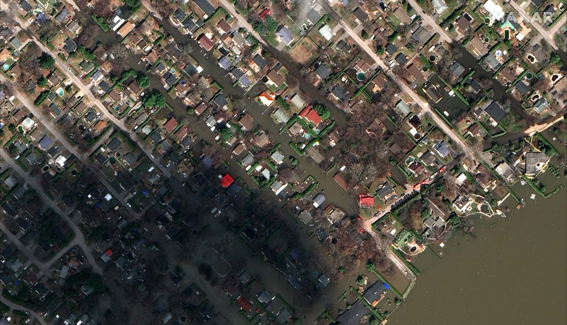
Greater Montreal has been among the regions most affected by this year’s spring floods, which also wreaked havoc in other parts of Quebec, Ontario and New Brunswick. Neighbourhoods along major rivers were inundated and evacuated, often for the second time in recent memory. Although many municipalities seemed better prepared than they had been during the last major floods in 2017, the extent and frequency of the recurring damage has government officials rethinking how flood-prone land should be used. Meanwhile, the financial strain on government disaster relief programs has prompted proposals to cap aid to homeowners and discourage rebuilding in certain areas. Life in some vulnerable neighbourhoods just became more uncertain.
The Globe and Mail obtained these recent satellite images of extensively flooded neighbourhoods from Maxar Technologies, a major imagery provider. Cloud-free imagery of many affected areas across Eastern Canada was unavailable.


Related coverage
More rain expected to hit flood zones in Quebec and Ontario by the weekend
 Matthew McClearn
 Mason Wright