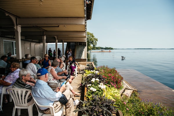
Theater-goers are kept away from the main dock at the Thousand Islands Playhouse in Gananoque, Ont., as it is completely under water. Normally, the audience would be able to enjoy a drink on the deck during intermission.JOHNNY C.Y. LAM
Recent floods remade the world Kristin Basso once knew.
She’s lived for 40 years at a farm on Lake Ontario in the northwestern part of Prince Edward County that includes a beach path for horse riding and a rental cottage. High water levels in 2017 and 2019 eroded as much as 10 meters from her shoreline. It erased hundreds of meters of her driveway, toppled trees, inundated her land and strewed beach rocks across former grassy fields.
Officials attributed this destruction to record-high precipitation throughout the Great Lakes region, exacerbated by climate change. But like many of the tens of thousands of people who live on the shores of Lake Ontario and the St. Lawrence River, Ms. Basso doesn’t buy that explanation. She believes she’s the victim of an international body’s decision to protect communities downstream by using the Great Lake as a sort of holding pond.
“If you don’t let water out of Lake Ontario because you’re protecting Montreal,” she says, “then we become the toilet bowl of all the Great Lakes.”
She’s referring to decisions made by the International Joint Commission (IJC), which regulates the water level on Lake Ontario and the St. Lawrence River. Its lone tool is the Moses-Saunders Dam in Cornwall, Ont. Built in the 1950s, the hydroelectric facility is the only man-made structure in all of the Great Lakes that significantly influences who gets flooded and who doesn’t.

Waters from a massive drainage area
pass through the Moses-Saunders Dam
ONTARIO
QUEBEC
Great Lakes regional
drainage basins
Lake Superior
DETAIL
WISC.
Lake
Huron
N.Y.
Lake
Mich.
Lake Ont.
Lake Erie
ILL.
PENN.
QUEBEC
Trois-Rivières
St. Lawrence River
ONTARIO
Montreal
Ottawa
Moses-Saunders Power Dam
Cornwall
VERMONT
Belleville
Kingston
Toronto
Lake Ontario
Niagara River
55
0
Lake Ontario
Drainage Basin
KM
N.Y.
JOHN SOPINSKI/THE GLOBE AND MAIL, SOURCE:
International Joint Commission; qgis; usgs;
TILEZEN; OPENSTREETMAP CONTRIBUTORS; HIU

Waters from a massive drainage area
pass through the Moses-Saunders Dam
ONTARIO
QUEBEC
Great Lakes regional
drainage basins
Lake Superior
DETAIL
WISC.
Lake
Huron
N.Y.
Lake
Mich.
Lake Ont.
Lake Erie
ILL.
PENN.
QUEBEC
Trois-Rivières
St. Lawrence River
ONTARIO
Montreal
Ottawa
Moses-Saunders Power Dam
Cornwall
VERMONT
Belleville
Kingston
Toronto
Lake Ontario
Niagara River
0
Lake Ontario
Drainage Basin
55
KM
N.Y.
JOHN SOPINSKI/THE GLOBE AND MAIL, SOURCE: Inter-
national Joint Commission; qgis; usgs; TILEZEN;
OPENSTREETMAP CONTRIBUTORS; HIU

Waters from a massive drainage area pass through the Moses-Saunders Dam
Quebec City
ONTARIO
QUEBEC
Trois-Rivières
Great Lakes regional
drainage basins
Lake Superior
St. Lawrence River
DETAIL
Montreal
WISC.
Lake
Huron
Ottawa
QUEBEC
N.Y.
Lake
Mich.
Lake Ont.
Moses-Saunders Power Dam
Lake Erie
Cornwall
ILL.
PENN.
VERMONT
Lake
Champlain
Belleville
Kingston
N.H.
ONTARIO
Toronto
Lake Ontario
NEW YORK
Hamilton
Niagara River
0
55
Lake Ontario
Drainage Basin
London
Buffalo
Syracuse
KM
JOHN SOPINSKI/THE GLOBE AND MAIL, SOURCE: International Joint Commission;
qgis; usgs; TILEZEN; OPENSTREETMAP CONTRIBUTORS; HIU
In determining how much water to release at any given moment, the IJC consults a collection of arcane procedures known as Plan 2014. The organization attempts to balance the interests of upstream and downstream communities, the shipping industry, hydroelectric producers and other parties. In advance of the shipping season, which began April 1, the IJC said it drained as much water as possible from Lake Ontario – but recently curtailed releases from the dam amid high water levels around Montreal.
Few Ontarians paid much attention when Plan 2014 was being drawn up. But after two disastrous years of serious flooding, property owner associations are calling on the IJC to make major revisions. Meanwhile, some irate local governments are trying to take the international body to court. The message: lower Lake Ontario’s level at all costs, even if that means inundating Montreal and other communities downstream.
Great Lakes tourism businesses struggle with record-high water levels
Rising waters in St. Lawrence Seaway could cost economy more than $1-billion, report says
IJC officials insist the 2017 and 2019 floods would have been worse and lasted longer, but for their interventions. Nevertheless, earlier this month they announced a two-year, $3-million review. It’s a zero-sum, high-stakes game that pits communities against one another to have the rules tweaked in their favour. And it’s the very sort of dispute Canadians can expect as a changing climate produces more extreme weather events.
‘Best possible plan’
The IJC’s role is essentially that of a peacekeeper. It was established by the United States and Canada by a 1909 treaty.
The IJC adopted Plan 2014 after 14 years of scientific studies and public meetings that cost $20-million. Actually implemented in 2017, it replaced an earlier regime called Plan 1958DD, which dated from the St. Lawrence Seaway’s opening. The new plan’s central feature was that it allowed Lake Ontario to rise and fall in a wider range than under the previous strategy, in an effort to repair damaged wetlands.
The IJC called it “the best possible plan.”
The other Great Lakes drain into Lake Ontario via the Niagara River, which provides more than 80 per cent of incoming water. Under normal circumstances, the IJC uses the dam to balance outflows with inflows to stabilize Lake Ontario. But record inflows since 2017 routinely exceeded its ability to drain it. Suddenly a great many people began wondering whether Plan 2014 really is the best possible option.
“A lot of people observe a change in water levels and conclude that it must have happened because of IJC’s outflow policies,” said Jane Corwin, the IJC’s U.S. section chair, during a public webinar last month. “But the reality is that the water level is affected as much by the amount of water coming in as by the policies for letting water out.”
The IJC says it can’t simply release limitless volumes of water through the Moses-Saunders Dam. For starters, downstream power plants couldn’t handle it. High flows would also erode land along the St. Lawrence River. Moreover, strong currents force commercial vessels to lower speed or – in extreme circumstances – halt traffic altogether, disrupting the regional economy. In winter, high flows can prevent the river from freezing over, leaving it more vulnerable to ice jams.
“Setting Lake Ontario outflows is a difficult and delicate balancing act,” said Ms. Corwin. “There are limits to what can be done.”
Those limits were tested last spring when the Ottawa River overflowed and flooded parts of Montreal. The IJC responded by curtailing the flow from Lake Ontario. (The body says that to lower Lake Ontario by 1 cm., water levels in Montreal must rise by 12 cm.)
In a report released in November, the Ontario government’s flooding adviser, Douglas McNeil, attributed the 2019 flooding to the sheer amount of snow and rainfall. He wrote: “Nothing points to human error or the negligent operation of water control structures as the cause of the flooding."
‘Outside the law’
That hasn’t placated opponents, many of whom believe Plan 2014′s tolerance of higher lake levels damaged their property. They want a new plan.
Isabel Bottigoni lives in a converted boathouse along the St. Lawrence River in Brockville, Ont. She’s moved all her furniture to the second storey and says local buildings were constructed with the expectations that water levels would remain within levels contemplated under Plan 1958DD.
“What I’m looking for is to share pain with downstream,” she said, “and don’t let shipping start until we’ve got this water out of the system.”
Plan 2014 includes a formula for limiting flooding damage on the lower St. Lawrence River; another limits water velocity in the Seaway to aid navigation. Sarah Delicate of Bowman, Ont., said those limits explain why her property flooded. “Lake Ontario has no hard stop,” she said. “We can go up a foot, two feet, three feet, four feet, five feet. There is no limit."
After 2017′s floods, she formed United Shoreline Ontario, an organization that has grown to about 800 members. “It can’t just be that Lake Ontario takes all the injury,” Ms. Delicate said. “Shipping has to take some injury. Montreal has to take some injury.”
Last fall, New York State sued the IJC in state court, accusing the body of prioritizing commercial shipping over the owners of riverside properties. The IJC has filed a motion to move the case to U.S. federal court. “We took every action available to us to try and reduce the flooding impacts,” said spokesperson Frank Bevacqua, “and we disagree with the lawsuit.”
In Ontario, the Municipality of Brighton passed a motion earlier this year asking its staff to explore legal options. The community includes many lakeshore cottages that were converted into year-round residences, many of which flooded during the last three years. Mayor Brian Ostrander said he wants to assess the prospects of suing the IJC to seek compensation for damages his community has suffered. He also wants the IJC to narrow the swings in lake levels. He expects to know his options in mid-April.
Lawsuits likely present little threat to the IJC. New York officials acknowledge that as an international organization, the IJC enjoys the same broad immunity enjoyed by foreign governments. The odds don’t look any better in Canada.
“Anecdotally, we know it’s difficult to file against an international body,” said Mr. Ostrander. “They seem to be outside the law.”
An alarming beginning to 2020
This year is shaping up to be another nail-biter. For months, Lake Ontario’s level has consistently been tens of centimetres higher than it had been in the run-up to the disastrous 2019 floods.

lake ontario water levels
March 2020, in feet
+6
+5
Projected
+4
Recorded
+3
+2
Average
1918-2019
+1
0
J
D
J
D
J
A
2018
2019
2020
JOHN SOPINSKI/THE GLOBE AND MAIl
SOURCE: u.S. army corps of engineers

lake ontario water levels
March 2020, in feet
+6
+5
Projected
+4
Recorded
+3
+2
Average
1918-2019
+1
0
J
D
J
D
J
A
2018
2019
2020
JOHN SOPINSKI/THE GLOBE AND MAIl
SOURCE: u.S. army corps of engineers

lake ontario water levels
March 2020, in feet
+6
+5
Projected
+4
Recorded
+3
+2
Average
1918-2019
+1
0
J
D
J
D
J
A
2018
2019
2020
JOHN SOPINSKI/THE GLOBE AND MAIL, SOURCE: u.S. army corps of engineers
That doesn’t mean flooding is assured: much depends on outflows from Lake Erie, rainfall and their factors. The U.S. Army Corps of Engineers forecasts Lake Ontario will peak at levels considerably below last year’s.
Yet Ms. Delicate says she’s seen forecasts that predict the lake could peak a full foot (30 cm.) higher – which “would be catastrophic."
Mr. Ostrander said that while he’s no fan of the IJC, it “has been doing and saying all the right things of late,” including draining Lake Ontario as quickly as possible.
“I just hope it’s enough for 2020.”
Our Morning Update and Evening Update newsletters are written by Globe editors, giving you a concise summary of the day’s most important headlines. Sign up today.
 Matthew McClearn