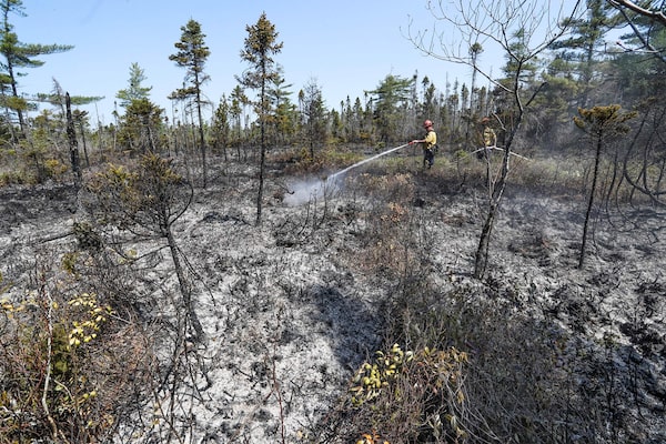
Firefighters Walter Scott and Zac Simpson spray the ground around Barrington Lake, N.S., on June 1.HANDOUT/AFP/Getty Images
If it seems like Western Canada has been ablaze for much of the past several years, it’s because it actually has. Alberta’s Slave Lake fire in 2011 and Fort McMurray in 2016, followed by British Columbia fires in 2017, 2018 and again in 2021: Many of the most consequential fires in Canadian history happened there recently.
At the opposite end of the country, the Barrington Lake wildfire had burned an estimated 235 square kilometres of southwestern Nova Scotia as of Monday. (It is classified as “being held” but still not under control.) While that may be tiny in comparison with the Fort McMurray fire, it has still been dubbed the largest wildfire in Nova Scotia’s history. Fires also burned extensive areas around Halifax, the provincial capital.
SOPFEU, Quebec’s fire protection agency, has recorded 449 fires so far this year across the province, 113 of which were active on Monday. The 750,000 hectares burned amount to more than 300 times the province’s 10-year average.
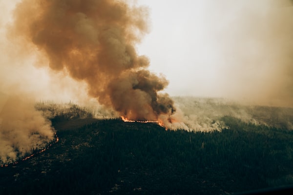
A wildfire west of Chibougamau, Que., on June 4.Audrey Marcoux/The Canadian Press
But is this apparent surge in fire activity Mother Nature’s way of putting Eastern Canada’s residents on notice that they’re condemned to follow their western countrymen into a harsher fire regime?
The term “fire regime” refers to broad patterns in the size, frequency, season length, intensity and behaviour of wildfires in a particular area. In some places, the crowns of trees are more likely to burn, whereas elsewhere fires might light ground cover and burn closer to the forest floor. How fires ignite – for instance, from lightning strikes or human causes – is often also considered. In recent centuries, firefighting capabilities have altered not only the balance of fires, but also the forests themselves. Climate plays an overarching, influential role.

Canadians coast-to-coast experience
strikingly different fire regimes
This map, from a 2018 study conducted by researchers at the Canadian Forest Service and the University of Alberta and published in the Canadian Journal of Forest Research, shows that the total area burned in large fires increased across much of Canada since 1959. But while fire regimes overall became more active over the last half century, the Eastern Temperate zone (which includes Nova Scotia) was the notable exception: the total area burned actually declined, and there was also “a significant decreasing trend” in the number of large fires each year.
Averaged annual trend in total area burned (hectares)
Fire regime
Increasing 301 to 1,000
Decreasing -300 to -100
Increasing 1,001 to 3,000
Decreasing -99 to -1
Increasing 3,001 to 7,000
Increasing 1 to 100
Increasing >7,000
Increasing 101 to 300
Significant trend
Eastern
Temperate
zone
Lake Athabasca
zone
Eastern James
Bay zone
Matthew mcclearn and john sopinski/the globe and mail,
source: NRCan Canadian Forest Service;Univ. of Alberta; QGIS;
Canadian Journal of Forest Research

Canadians coast-to-coast experience strikingly different fire regimes
This map, from a 2018 study conducted by researchers at the Canadian Forest Service and the University of Alberta and published in the Canadian Journal of Forest Research, shows that the total area burned in large fires increased across much of Canada since 1959. But while fire regimes overall became more active over the last half century, the Eastern Temperate zone (which includes Nova Scotia) was the notable exception: the total area burned actually declined, and there was also “a significant decreasing trend” in the number of large fires each year.
Averaged annual trend in total area burned (hectares)
Increasing 301 to 1,000
Fire regime
Increasing 1,001 to 3,000
Decreasing -300 to -100
Decreasing -99 to -1
Increasing 3,001 to 7,000
Increasing 1 to 100
Increasing >7,000
Increasing 101 to 300
Significant trend
Eastern
Temperate zone
Lake Athabasca
zone
CANADA
UNITED STATES
Eastern James
Bay zone
Matthew mcclearn and john sopinski/the globe and mail, source: NRCan Canadian Forest Service;
University of Alberta; QGIS; Canadian Journal of Forest Research
So, it’s no surprise fire regimes are not consistent across the country, nor over time. It’s also hardly shocking that researchers disagree somewhat on precisely how fire regimes are changing, or why.
Indeed, where Canada’s fire regimes begin and end is a matter of debate. Many researchers have used ecozones (large areas with contiguous climate, geological features and vegetation) as a stand-in. But applying a highly complex process, the Canadian Forest Service arrived at 16 distinct fire regime zones across Canada about a decade ago.
What’s beyond dispute is that fire regimes differ radically. A 2018 study led by researchers at the Canadian Forest Service and based on those 16 fire regime zones, found that the average area burned annually had increased significantly between 1959 and 2015: large fires, which account for the lion’s share of scorched earth, increased in number and size. But that increase was concentrated in Western Canada, where large fires caused by lighting strikes became substantially more frequent.
The “Eastern Temperate” zone – which includes Nova Scotia and much of New Brunswick – was a notable exception. There, the number of large fires, and the resulting scorched earth, trended downward.
Why the difference? For one thing, the west coast is dominated by “temperate coniferous” forests, whereas Eastern Canada has “mixed” forests and Central Canada is primarily “boreal” forests. The forest type that dominates the Maritimes (known as the “Wabanaki”or “Acadian’ forest) has a greater mix of hardwood species that are less likely to burn.
“The fire regime is very different here in the Maritimes, or the Wabanaki forest region, compared to the boreal forest,” said Megan de Graaf, a forest ecologist at Community Forests International, an organization that works with landowners to protect forests in the Maritimes.
Anthony Taylor, a professor of forest management at the University of New Brunswick, said people cause more than 95 per cent of fires in the Maritimes. Studies have shown that the decreased number of fires, and the area burned, throughout the 20th century was largely due to increasingly effective firefighting.
“There’s this popular misconception that the forests in the Maritimes don’t burn because it’s too wet,” said Prof. Taylor. But studies he’s been involved in have found that before European colonization, the region’s forests burned with return periods of between two and six centuries, as compared to 50 to 100 years in the West.
When putting Quebec’s active fire season into context, Sylvie Gauthier, a research scientist with the Canadian Forest Service, warned against relying too heavily on comparisons with annual averages.
“Fire regime is a question of extremes,” said Ms. Gauthier. “For the entire boreal forest of Quebec, there’s one big fire year every six or seven years, usually. So when you look at the average, it’s not indicative of what really happens.”
Indeed, this extreme variability greatly complicates research. The preponderance of rare, extreme events makes identifying trends difficult.
Ms. Gauthier says Quebec’s fire regime changed little over the last 20 years. But she and colleague Martin Girardin have studied the province’s fire regime over much longer periods, as long as 8,000 years. And when you zoom out that far, you begin to appreciate how variable long-term fire patterns can be.
“What really drives the fire regimes are the dry periods,” Ms. Gauthier said. “We had at the beginning of the 20th century, so from 1916 to 1923, huge seasons and consecutive seasons that were really dry where the real burn was really high in Quebec.”
Fire researchers have long warned that a warming climate will radically alter fire regimes yet again. A federal survey of climate projections in 2019 cautioned that extreme heat would increase the severity of heatwaves, contributing to increased drought and wildfires.
Ms. de Graaf said the pre-colonial Wabanaki forest was relatively old and complex, with a great diversity of species. But intensive timber harvesting has destroyed 99 per cent of that forest, which has been replaced by a younger forest with fewer species.
“The forest is now more vulnerable to the effects of climate change,” she said.
Prof. Taylor said projections suggest the area burned in the Maritimes could double by the end of this century – a suggestion echoed by Ms. Gauthier.
“Even in places where it didn’t burn a lot, we expect that it would burn more,” Ms. Gauthier said. “Almost all models predicts at least a doubling between now and the end of the century.”
As for the immediate future, the outlook for this fire season remains dark: In a briefing last week, Natural Resources Canada officials said higher-than-normal fire activity could continue throughout most of Canada through to August.
 Matthew McClearn