This is the second of a three-part series following glacier researchers from British Columbia’s Coast Mountains to the lab as they try to unearth climate history. In Chapter 1 and the episode of The Decibel below, reporter Justine Hunter explains how the researchers collect, store and analyze ice-core samples.
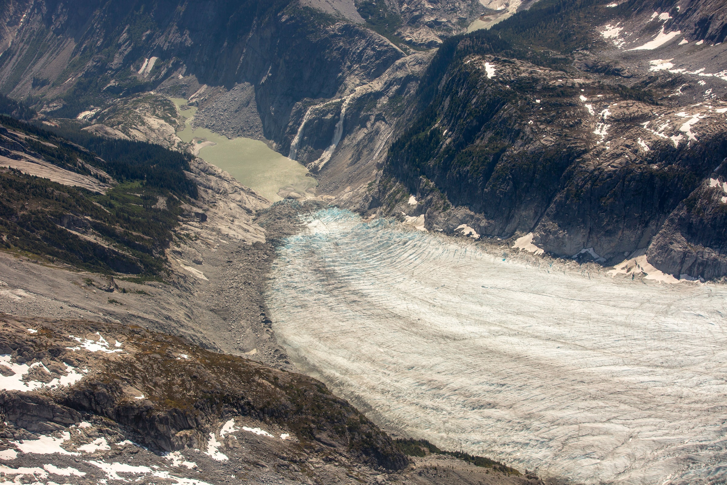
By helicopter, the views of British Columbia’s Coast Mountains are postcard perfect: black spires of rock and turquoise lakes unfold against vast icefields dressed in white snow.
But when Brian Menounos, one of Canada’s leading authorities on glacier change, looked out on the landscape at the beginning of July, he saw only what was missing.
Where once there was snow cover, there is now bare ice. And where there was ice, there is instead exposed bedrock and sediment known as glacial till. “It’s hard to believe so much of this will be gone by the end of the century,” he said through the aircraft’s headset.
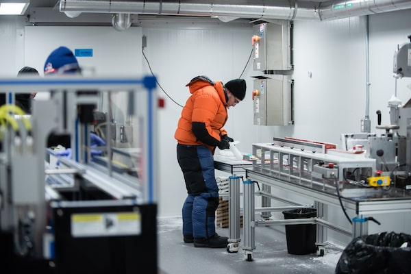
The helicopter delivered him to a camp at Mount Waddington, in the heart of the Pacific coast ranges, to check on an ice-coring project that aims to retrieve hundreds of years of climate data – a historical record that currently only exists in small fragments in this region.
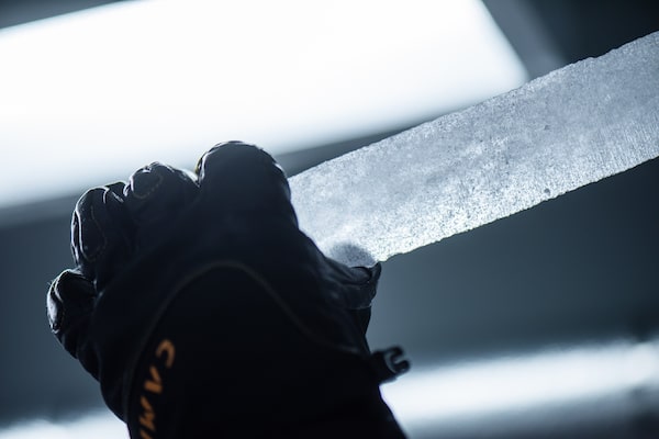
Top, Dr. Brian Menounos prepares an ice core for subsampling at the Canadian Ice Core Laboratory in Edmonton, Alta. in October 2023. When held up to the light, air bubbles and debris are visible within the ice core sample.Kelsey McMillan/The Globe and Mail
Dr. Menounos, a professor of earth sciences at the University of Northern B.C. and a chief scientist with the Hakai Institute, is part of a Canada-U.S. research team that is racing to capture the environmental history written in this glacier ice before it deteriorates.
Ice cores from the polar regions offer unmatched archives of Earth’s climate history – preserving records that have been in direct contact with Earth’s atmosphere going back tens of thousands of years. But these mountain glaciers in Western Canada can provide a different kind of record. They have witnessed climate events that can help forecast the future in the region where millions live. Recorded in the ice are hundreds of years of temperatures and precipitation, and the scale and frequency of wildfires before modern fire suppression tactics began.
As well as following Dr. Menounos and his colleagues to the icefields of Mount Waddington, The Globe and Mail spoke with climate experts to help us learn how this research will lead to a better understanding of the deadly heat waves and catastrophic floods and fires enveloping Western Canada – as well as the impact of disappearing glaciers on our watersheds.

Substantial glacier mass loss continues
for Western Canada
Scientists from the Hakai Institute and the University of
Northern British Columbia regularly perform airborne
geophysical surveys to quantify glacier change. The map
below shows elevation change over the Mount Waddington
region between the summers of 2020 and 2023.
Detail
BRITISH COLUMBIA
Kamloops
Coast Mountains
Port McNeill
Vancouver
Island
Vancouver
Pacific Ocean
Victoria
WASH.
Seattle
100 km
Elevation
loss
Scimitar Glacier
0
30m
Combatant Col
Tiedemann Glacier
Mount Waddington
Franklin Glacier
BRITISH COLUMBIA
5 km
john sopinski/the globe and mail, Source: Brian Menounos, unbc
and hakai institute; openstreetmap

Substantial glacier mass loss continues for Western Canada
Scientists from the Hakai Institute and the University of Northern British Columbia regularly perform
airborne geophysical surveys to quantify glacier change. The map below shows elevation change
over the Mount Waddington region between the summers of 2020 and 2023.
Detail
BRITISH COLUMBIA
Kamloops
Coast Mountains
Port McNeill
Vancouver
Island
Vancouver
Pacific Ocean
Victoria
WASH.
Seattle
100 km
Elevation
loss
Scimitar Glacier
0
30m
Combatant Col
Tiedemann Glacier
Mount Waddington
Franklin Glacier
BRITISH COLUMBIA
5 km
john sopinski/the globe and mail, Source: Brian Menounos, unbc
and hakai institute; openstreetmap
Glaciers are not static. Through the seasons and longer climate cycles, they accumulate mass in the form of snowfall, and they shed mass, typically as vapour or water. When those two processes are in balance, the glacier is in equilibrium. B.C.’s Coast Mountain glaciers have been rapidly shrinking since the 1980s, and climate change is now at the point that the scales are tipping fast.
Dr. Menounos has tracked the mass of glaciers in Western Canada since 2015, including aerial surveys of 800 glaciers over the past three years. Both 2021 and 2022 were bad years, with significant losses. This year is far worse, owing to an early heat wave compounding drought and widespread wildfires. The pace of change is accelerating.
“We are observing mass loss that is several times greater than any other year,” he said.
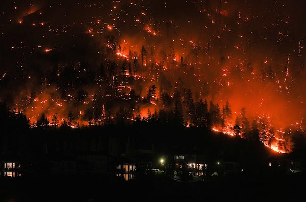
At the same time, Canadians from coast to coast to coast experienced extreme fire weather conditions in 2023. This not only led to massive forest losses but has compounded the erosion of glaciers.
Anomalous heat and persistent drought in most parts of the country dried out forests and depleted icepacks. And the massive greenhouse gas emissions from this year’s forest fires – which are expected to exceed Canada’s total emissions from heavy industry – undermine global efforts to slow the pace of climate change.

Risk of forest fires in Canada
This map shows standarized anomalies of the Forest
Wildfire Index for June-August which is a composite of temp-
erature, relative humidity, wind speed, and precipitation
variables. High values indicate higher forest fire risk.
-3
-2
-1
0
1
2
3
Standard deviations
the globe and mail, Source: https://feux.escer.uqam.ca

Risk of forest fires in Canada
This map shows standarized anomalies of the Forest Wildfire Index for June-August which is
a composite of temperature, relative humidity, wind speed, and precipitation variables. High
values indicate higher forest fire risk.
-3
-2
-1
0
1
2
3
Standard deviations
the globe and mail, Source: https://feux.escer.uqam.ca
When soot and ash from wildfires leave a dark blanket on the glaciers, the darker surfaces absorb more sunlight in the summer, causing the ice to melt faster. “We haven’t really fully appreciated how important these feedback loops are,” Dr. Menounos said, “but we’re starting to see that play out in real time.”
This year, the record loss of glaciers coincided with record fires.
By October, eight times more land burned in 2023 in Canada than in an average year, and that won’t be the final tally. Some of the wildfires that are still burning are expected to smoulder through the winter and re-emerge in the spring.
DARRYL DYCK/The Canadian Press

Top, the McDougall Creek wildfire burns on the mountainside above houses in West Kelowna, B.C., and below, property destroyed by the Lower East Adams Lake wildfire in Scotch Creek, B.C., both in August of this year. The 2023 wildfire season is the most destructive ever recorded in the province, based on the total area burned.DARRYL DYCK/The Canadian Press
Ellen Whitman, a forest-fire research scientist with the Canadian Forest Service, said the conditions that fed 2023’s fires were exceptional. “This year, we had the highest-recorded seasonal fire weather index – a metric that’s based on weather conditions at a given time that predicts fire risk and also fire behaviour.”
Dr. Whitman is not involved in the glacier ice research project at Mount Waddington, but she is eager to find out what Dr. Menounos and his colleagues learn about past wildfire patterns – not just the frequency, but the severity of those fires.
“Putting years like this one into context with our historical record is super important for a lot of different reasons,” she said. “It helps us contextualize the problems and management issues that we may face, and it helps us understand how extreme things could become in the future as well.”
Many of Canada’s forests are well adapted to fire, she noted. “They evolved alongside fire over many, many years, from the period of first glaciation, until the forests that we have now,” she said. But the megafires that burned this year have, in places, literally scorched the earth. That can leave behind a landscape more prone to flooding and landslides, as B.C. witnessed in November, 2021. Understanding if this intensity is outside of historic patterns is critical.
Climate Innovators and Adaptors
This is one in a series of stories on climate change related to topics of biodiversity, urban adaptation, the green economy and exploration, with the support of Rolex. Read more about the Climate Innovators and Adaptors program.
“This year we had multiple fires that were over a million hectares in size – something like 16 fires were responsible for the vast majority of that area burning this year,” she said.
And, Dr. Whitman adds, this year’s fires might have a permanent effect. “This higher severity can lead to forest loss or very low-density forests,” she explained.

Mounting losses
This chart shows that Mount Waddington glaciers thinned
most at lowest elevations where temperatures are warmest.
The glaciers within this area (700 km2) are losing 1 billion
tonnes (gigatonne) of water annually, equivalent to one
cubic kilometre.
0
-5
Elevation change (metres)
-10
-15
Uncertainty range
-20
-25
500
1,000
1,500
2,000
2,500
3,000
3,500
4,000
Elevation (metres above sea level)
john sopinski/the globe and mail, Source: Brian Menounos, unbc and
hakai institute

Mounting losses
This chart shows that Mount Waddington glaciers thinned most at lowest elevations where
temperatures are warmest. The glaciers within this area (700 km2) are losing 1 billion
tonnes (gigatonne) of water annually, equivalent to one cubic kilometre.
0
-5
-10
Elevation change (metres)
-15
Uncertainty range
-20
-25
500
1,000
1,500
2,000
2,500
3,000
3,500
4,000
Elevation (metres above sea level)
john sopinski/the globe and mail, Source: Brian Menounos, unbc andhakai institute
Losing glaciers will have significant consequences in the future.
Mountain glaciers, which scientists have warned are on track to lose half of their mass by the year 2100, are a critical water resource for nearly two billion people around the globe.
Glaciers can also serve as a buffer against extreme events like drought. A key reason for the extreme fire weather rating across the country, which Dr. Whitman charted this year, was the extended drought that began in 2022.
Even into October of this year, most of Western Canada remained in an extreme drought. Many communities imposed water restrictions, while the village of McBride, in B.C.’s Interior, declared a local state of emergency to save their dwindling water supply for drinking, fire protection and sanitary service.
B.C.’s Minister of Emergency Management and Climate Readiness, Bowinn Ma, sounded the alarm in September: “I want to emphasize how significant the drought that British Columbia is facing is right now. It is unlike any kind of drought conditions the province has ever faced, and in my opinion, truly is a sleeping giant of a natural disaster that we are challenged with right now.”
Glaciers have been the saviours for some of B.C.’s watersheds because they replenish water supply when the seasonal snowpack is gone. “Glaciers are Mother Nature’s natural reservoirs. They are, in many cases, finely tuned to climate and they release cool, plentiful water when it’s needed,” Dr. Menounos said.
Drought conditions in 2023 have caused low water levels in the dugout reservoir at Amara Farm in Courtenay, B.C.Andrew Querner/The Globe and Mail
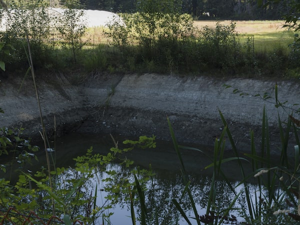
The drought that started in 2022 led to mass die-offs of salmon, and, this summer, biologists on the West Coast and the B.C. Interior once again worked to try to save salmon trapped by low water. As the glaciers in B.C.’s coastal mountains shrink, the replenishment of rivers will eventually face persistent disruption. According to Dr. Menounos, that puts entire ecosystems at risk.
“If you take away those glaciers, you increase the vulnerability of those headwater creeks to extreme warm events and low-flow conditions. And this has consequences not just for salmon, but for any fish or aquatic ecosystem that is sensitive to thermal stress.”
For Indigenous communities that have relied on these ecosystems for their sustenance for thousands of years, the fate of glaciers is of grave concern.

Homalco First Nation Chief Darren Blaney addresses researchers at Combatant Col in July 2023.GRANT CALLEGARI/HAKAI INSTITUTE/Handout
Chief Darren Blaney, elected leader of the Homalco First Nation, joined Dr. Menounos in July on the trip up to Combatant Col, a saddle of ice and snow that rests between Mount Waddington and Mount Combatant. According to Dr. Menounos’s calculations, the col is 4.5 metres thinner now than it was in 2020, and the glaciers that flow from the col permanently lost one billion metric tonnes of water in this year alone.
Speaking to the research team at the camp, Mr. Blaney explained the central role of this mountain in his people’s origin stories, as the source of the north wind. The weather up here influences what happens down in Bute Inlet, within the Homalco traditional territories.
Mr. Blaney said the salmon of Bute Inlet are a keystone species, supporting many species, and he fears for what the future might hold.
“Our culture is tied to the health of our environment. The changes we are seeing, it’s a little bit scary.”
Podcast: Justine Hunter on The Decibel
Glacial ice can offer clues about the climates of eons past. But how do researchers collect, store and analyze them? On this episode of The Decibel, reporter Justine Hunter explains. Subscribe for more episodes.
Up next, Chapter 3: Into the lab
Eric Steig has spent more than 20 years seeking to pry open the climate history of B.C.’s southern glaciers. Standing in the Canadian Ice Core Lab, dressed for polar temperatures with his breath condensing into clouds around him, he laid the oldest cylinder of ice from an expedition at Mount Waddington onto a cradle and fired up a saw to remove a thin slice along the length.
 Justine Hunter